Regional Overview: I-10 Corridor
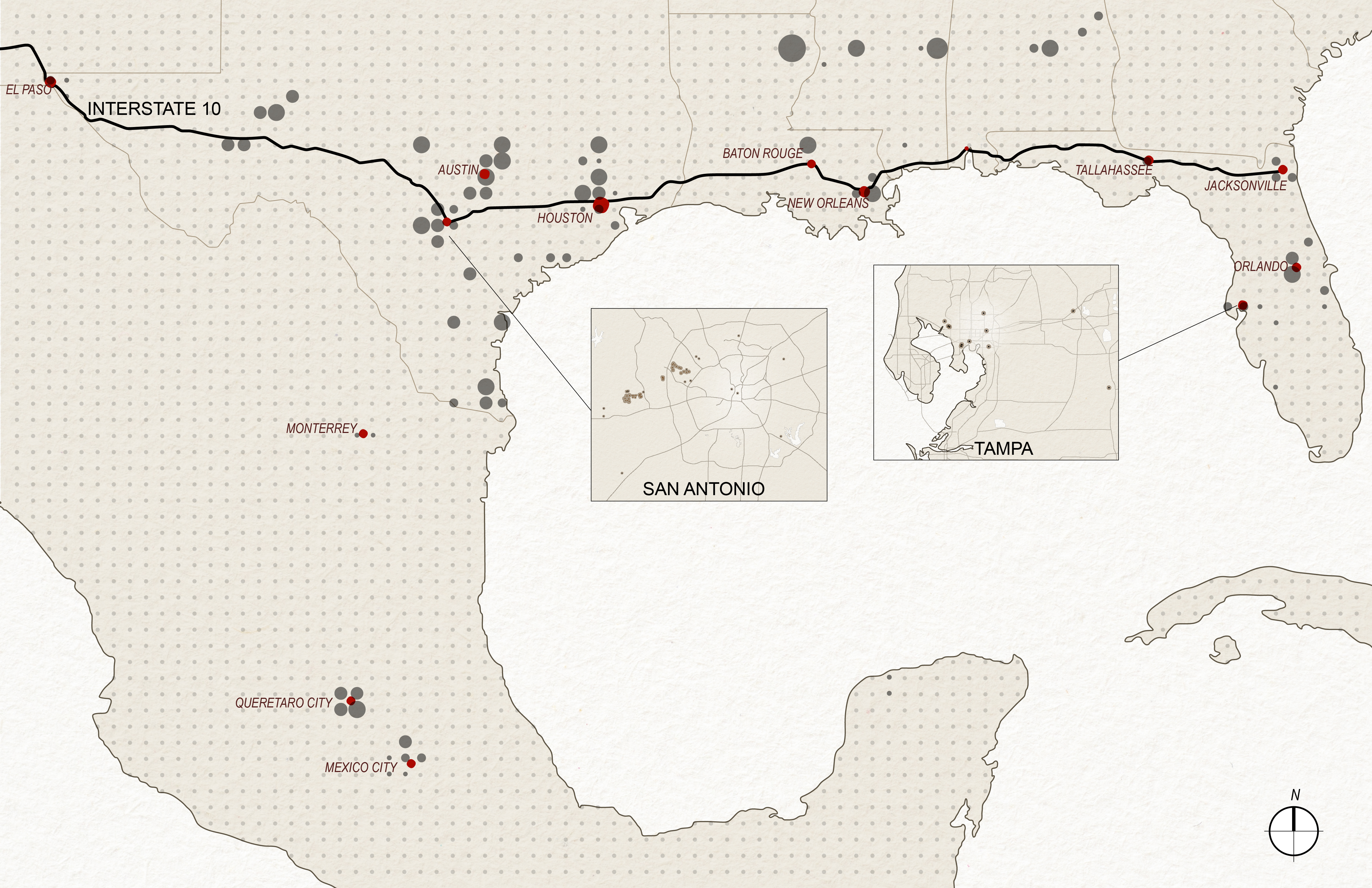
Data centers are one of the most rapidly emerging building typologies in North America. These facilities store data servers and equipment necessary for supporting digital services and cloud computing, varying greatly in size, placement, and construction. This wiki provides visual and data-driven information to highlight the decision-making factors for these variations, focusing specifically on their development along the I-10 corridor and the broader Gulf Coast, including Mexico. This book begins with the broader region’s role in U.S. data infrastructure, with more detailed state and city-level analyses in the chapters that follow. The opening map offers the widest geographic view, detailing how these facilities are distributed across multiple states at various scales.
At this large scale, the corridor itself appears more arbitrary than decisive. Pertaining to size and placement, distinct patterns only emerge when the data is viewed in more localized regions. Site placement is often dependent on factors specific to each city/state, causing a range of patterns from city to city. Centers do, however, tend to cluster around major metropolitan areas and along major interstate and fiber routes, with Interstate 10 acting as one of multiple backbones for regional connectivity. Texas currently hosts the greatest concentration and overall capacity, while Florida follows at a distance; Louisiana, Mississippi, and Alabama show a lighter and more scattered presence.
The dotted grid highlights location and average facility size, with larger dots signifying areas that contain larger data centers ( > 100,000 sqft on average) and smaller dots signifying smaller centers ( < 20,000 sqft). Later chapters examine the conditions that shape these differences, including state energy markets, corporate strategies, and case studies of unique sites, shifting from this broad regional overview toward the smaller scope of individual states and cities.
No comments to display
No comments to display